The complete guide · Twyfelfontein · Desert elephants · Spitzkoppe · Brandberg
Namibia's raw north-west — an unfenced country of ancient rock art, lava-shaped mountains, dry riverbeds walked by desert-adapted elephants, and horizons so wide they change what "quiet" means. Damaraland rewards travellers who plan well, pack smart, and slow the pace down until the landscape reveals itself. This is how to do it right.
Damaraland lies in north-western Namibia, part of the wider Kunene Region, stretching from Outjo and Khorixas in the east across to Brandberg Mountain and up towards Sesfontein. It sits between Etosha National Park and the Skeleton Coast — country most travellers pass through, and too few pause inside.
What Damaraland isn't: a national park with clear boundaries and a rest camp system. It's a large, sparsely-populated, unfenced region of conservancies, small settlements and private concessions. Wildlife moves freely; roads are mostly gravel; services are far apart. That remoteness is the point.
The three anchors in the map above tell the story:

Three ways to reach Damaraland, in order of popularity:
Damaraland distances look short on a map and long on the road. Plan around 50–60 km/h average on gravel, not the 80 km/h you might drive elsewhere.
| From | To | Distance | Approx driving |
|---|---|---|---|
| Windhoek | Twyfelfontein area | ±430 km | 5–6 hours |
| Etosha (Anderson Gate) | Khorixas | ±325 km | 3–4 hours |
| Khorixas | Twyfelfontein core | ±97 km | 2 hours (gravel) |
| Swakopmund | Twyfelfontein area | ±430 km | 5–6 hours (via Uis) |
| Twyfelfontein | Palmwag | ±110 km | 2 hours |
| Twyfelfontein | Spitzkoppe | ±280 km | 4 hours |
The 4×4 question: a high-clearance SUV can handle the main routes, but a proper 4×4 is strongly recommended if your itinerary reaches deeper concessions, riverbeds or remote lodges. Details in our car hire guide.
Every landmark in the corridor map above, with what to expect and how to visit it.
The single most important thing to see in Damaraland — more than 2,500 rock engravings and paintings, some over 6,000 years old, carved into red sandstone by early hunter-gatherers. Animals, human figures, hunting scenes, and what may be early forms of mapping. It's Namibia's first UNESCO World Heritage Site, and the guided walk is what makes it come alive.
Tip: take the guided walk (not the DIY loop) — the context is what the site is for. Go early morning to beat the heat and the coach traffic.
Two geology set-pieces almost next to each other. Burnt Mountain is a dark ridge left by an ancient lava flow — it glows red and purple at sunset. The Organ Pipes are tall dolerite columns sculpted by volcanic activity and erosion, resembling pipe-organ ranks in a shallow gully. Both are easy to reach, quick to visit, and photograph well.
Tip: visit late afternoon for Burnt Mountain — the colour shift is the whole point.
Enormous tree trunks turned to stone over hundreds of millions of years, scattered across the desert floor. Ancient floods carried and buried them; erosion has now uncovered the fossilised remains. Walking through it feels like a prehistoric graveyard of giants. Guides on-site explain how a rainforest ended up in what's now a desert.
Tip: combine with the Welwitschia plants that grow nearby — some individuals here are up to 2,000 years old.
A dramatic limestone pillar standing alone on the plains — an eroded remnant of an ancient plateau. One of Damaraland's most photographed landmarks, and best at sunset when the low light rakes across it. The nearby lodge overlooks it directly.
Tip: a sundowner at Vingerklip Lodge is a rite of passage — book ahead in high season.
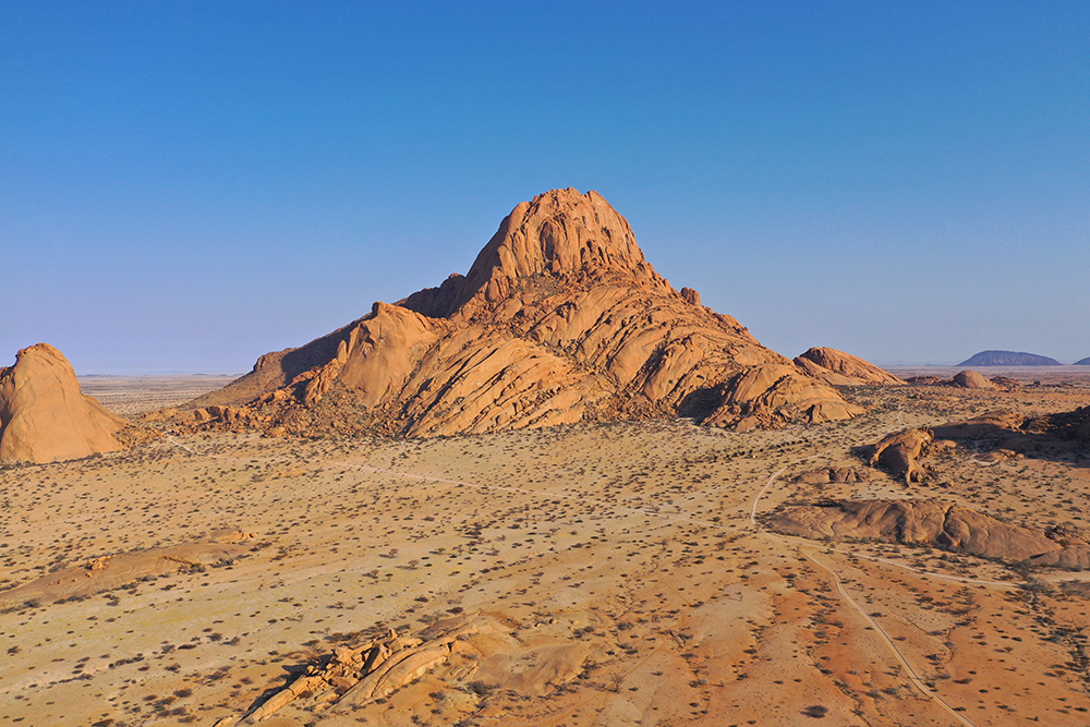
The "Matterhorn of Namibia" — a striking group of granite peaks rising suddenly from flat plains, glowing orange at sunrise and sunset. Ancient San rock paintings hide in shelters at the base. The community campsite among the boulders is one of the great Namibian stargazing spots.
Tip: allow half a day minimum. Book the arch and rock-art guide at the entrance gate.
Namibia's highest peak (2,573 m), and home to the famous "White Lady" rock painting in the Tsisab Ravine. A guided walk from the base takes 2–3 hours return; the painting itself is smaller than most expect but the setting and context are extraordinary. Rich in wildlife and further rock art the guides know how to find.
Tip: start very early — the ravine walk is exposed and hot by mid-morning.
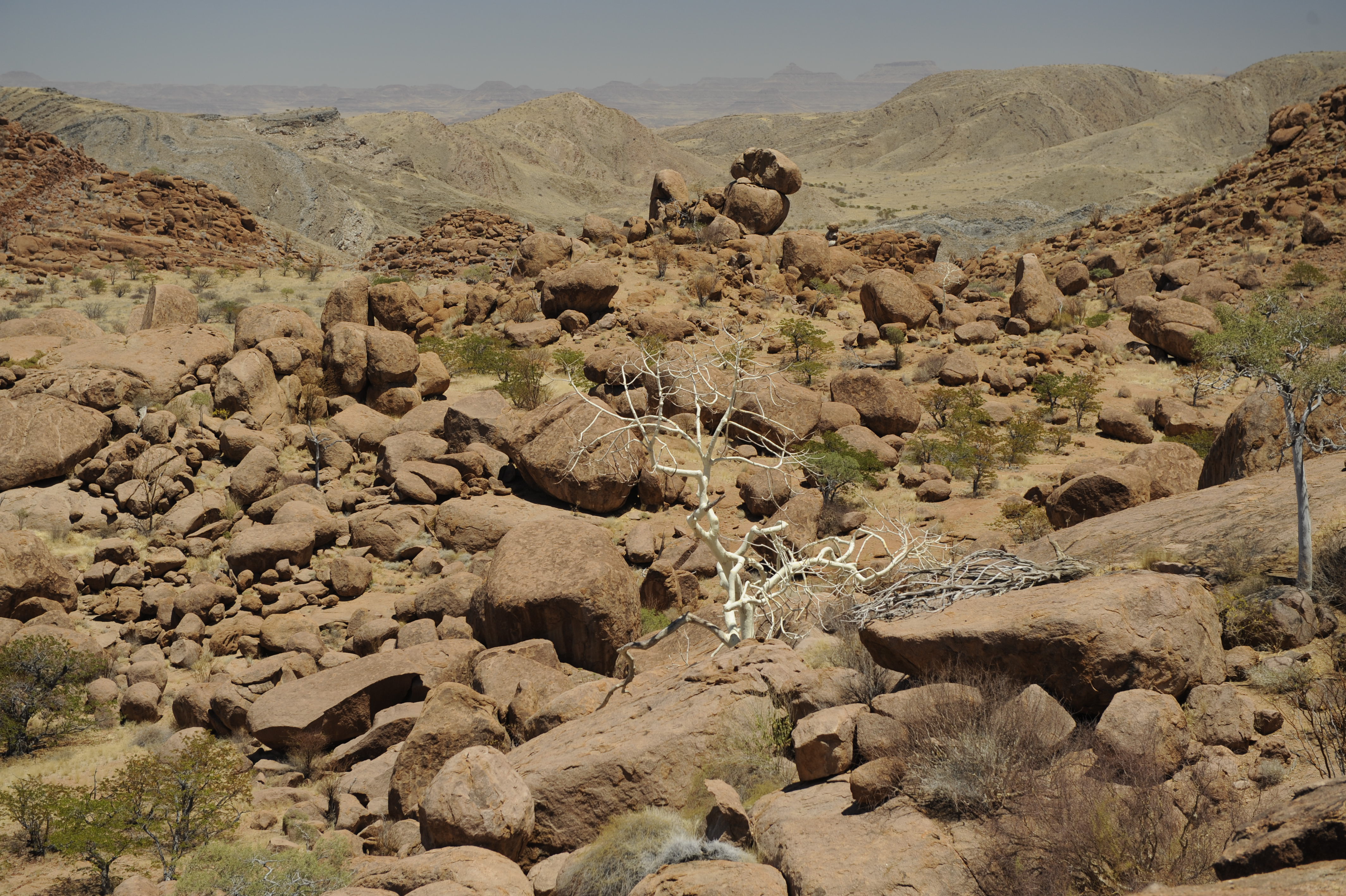
Damaraland's wildlife is the country's most distinctive — animals that have learned to survive in an almost waterless environment, in landscapes with no fences, on their own terms. Sightings feel personal because there's no crowd around them, and often no road.
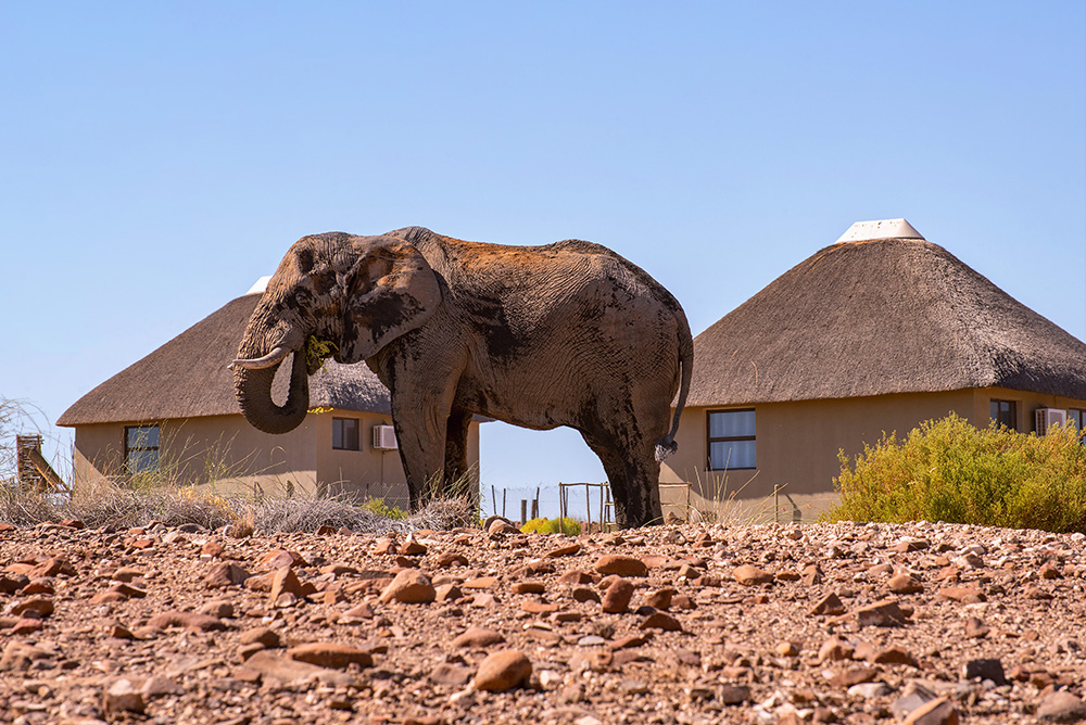
The signature wildlife of Damaraland. These elephants travel enormous distances between water sources, know exactly where to dig for underground water, and have adapted physically — longer legs, broader feet, smaller bodies — to their environment. Best seen with a specialist guide from a desert-elephant concession lodge.
Namibia's mountain zebra, thriving on sparse grasses and steep, rocky terrain the plains zebra never touches. Distinguishable by the stripes not meeting on the belly and the extra "dewlap" under the chin. Damaraland is one of the best places to see them.
The Palmwag Concession holds the largest free-roaming black rhino population outside a national park. Sightings are rare and never guaranteed, but the tracking experience — with Save the Rhino Trust or a concession lodge — is world-class. Never geotag or share exact locations.
A living fossil found only in Namibia and southern Angola. Just two strap-like leaves that grow the entire life of the plant, and some individuals are up to 2,000 years old — older than the Twyfelfontein engravings, older than the Roman Empire. Easy to see near Khorixas.
A small mammal with an eusocial colony structure — roles, castes, workers, queen — a behaviour otherwise seen in ants and bees, extraordinarily rare in mammals. You won't spot one, but knowing they're underground where you're driving adds something to the day.
Oryx skylined on ridges, giraffe browsing the mopane, springbok in scatterings, kudu at dawn near waterholes, ostrich crossing the tar, jackal and bat-eared fox for the patient. Damaraland's regulars are as memorable as its rarities.
Never geotag rhino sightings — locations are actively used by poachers who monitor social media. This is the one rule every conservancy asks of visitors, and it's not negotiable. More detail in our safari photography guide.
Damaraland takes its name from the Damara people, one of Namibia's oldest indigenous groups. The rock art at Twyfelfontein is one thread of that heritage; the living culture is another. Both are worth your time.
The engravings are far more than pretty carvings. They record wildlife, hunting scenes, spiritual figures, and what may be early forms of mapping — a Neolithic library etched in sandstone. A good guide will show you the rhino-lion transformation figure, the "dancing kudu", and the enigmatic depictions of animals not found here for thousands of years (a hint that the climate was very different then).
A community-run museum near Twyfelfontein, offering a working demonstration of traditional Damara life: clothing, crafts, medicine plants, fire-making, hunting techniques, dance and song. It's educational without being a performance for tourists — the participants are members of the local community sharing their heritage, and the fees support them directly.
The Damara language uses clicks — one of the click-consonant languages of southern Africa that once stretched much further before Bantu migration. Musical bows, ostrich-eggshell jewellery, and traditional beading are craft traditions still practised. Small stalls near lodges and cultural sites sell authentic pieces; buy directly from makers where you can.

Damaraland accommodation runs from very basic to genuinely luxurious. The right pick depends on your budget, your appetite for adventure, and how remote you want to feel.
Campsite · Self-drive · Riverbed
Beside the Aba Huab River near Twyfelfontein — basic facilities, plenty of space, and good chances of desert-elephants passing through the riverbed. Quiet, scenic and popular with self-drivers who want to be close to the rock art.
Campsite · Community-run · Rustic
A community campsite set among rocky hills. Facilities are simple, but the setting is beautiful and staying here supports the local community directly. For travellers who value authenticity over amenity.
Campsite · Iconic setting · Stargazing
Pitched among the granite peaks of Spitzkoppe. Basic facilities, extraordinary location, and one of Namibia's great stargazing spots. Photographers and hikers plan trips around this one place.
Mid-range · Rondavel style · Convenient
Near Khorixas with distinctive rondavel-style rooms and a relaxed atmosphere. Meals included, well positioned for visiting Twyfelfontein and surrounding attractions. Popular with self-drive travellers looking for a soft-landing overnight.
Mid-range · Rock-art proximity · Reliable
Closest lodge to the Twyfelfontein rock engravings — architecturally blended into the sandstone. Comfortable rooms, reliable food, and the best base if the rock art is your headline reason for coming.
Mid-range · Scenic chalets · Sunsets
Overlooks Vingerklip itself, with spacious chalets and one of Damaraland's finest sunset views. Peaceful, romantic, and a favourite with couples looking to add a distinctive night to the classic route.
Luxury · Eco-design · Intimate
Built directly among granite boulders and designed to blend into the landscape. Small and intimate, with guided nature activities, excellent food and a strong sense of place. A signature Damaraland luxury experience.
Luxury · Concession · Elephant tracking
In a private concession focused on desert-elephant conservation. Strong guiding, community partnership and some of the best-organised elephant-tracking experiences in the region. For travellers with the wildlife as top priority.
Luxury · Boulder-set · Views
Set into the rocks with sweeping views and elegantly furnished rooms. Combines architectural drama with a deep connection to the landscape — one of the most photographed lodge settings in Namibia.
A common rhythm: one night mid-range near Twyfelfontein for the rock art, plus one or two nights luxury in a concession for the elephant tracking. Campsite trips work brilliantly for self-drivers with kit and time.
Damaraland has a dry desert climate — sunshine most of the year, low humidity, big day-night temperature swings.
The classic answer. Days a pleasant 20–25°C, mornings and evenings cold (near-freezing in June/July at times), skies clear, wildlife gathering near dwindling water sources. Best for first-time visitors, hiking, rock-art walks and stargazing.
Hot (35°C+) with dry heat that can feel intense at midday. The rainy season is short thunderstorms rather than constant rain — when it does fall, riverbeds may briefly flow and the landscape softens to a hint of green. Dramatic skies for photographers, fewer travellers, greener contrast.
Some of the most enjoyable months. April holds a little green after the rains and comfortable temperatures. September is dry and increasingly warm, excellent for wildlife as water sources shrink. October begins to feel hot — do the walking early and late.
Cross-check with our when-to-visit Namibia guide if you're planning the wider trip — Damaraland's rhythm sits inside the country's broader pattern.

Think practical, comfortable, and prepared for temperature swings. Damaraland is off-grid; forgetting something is not a shop-run away.
Cross-check with our safari packing guide for the printable 48-item checklist.
Range from weak to non-existent. Signal is limited to towns like Khorixas and occasional high viewpoints. Once out on the open plains, expect to be genuinely off the grid. MTC has the widest coverage in Namibia — a local SIM before you head in is the standard move. For truly remote self-drive (Kaokoland-adjacent tracks, deep concessions), a rental satellite phone is worth considering.
Limited and slow where it exists — usually only in the main areas of lodges, and prone to power-cut outages. Don't rely on it for remote work or big uploads. Download offline maps, save contacts, screenshot bookings before you drive in.
Always carry cash. Many campsites, community operations and small businesses don't accept cards; even those that do can be defeated by poor cell signal. Fuel stations in small towns often work cash-only.
Extremely limited. Small clinics in Khorixas cover the basics; serious cases evacuate to Windhoek or Swakopmund. Comprehensive travel insurance with medical evacuation cover is not optional here — see our malaria & health guide for the full picture.
Damaraland is child-friendly, with caveats. The unfenced landscapes are magical for young travellers — but wildlife moves freely, roads are long and gravelly, and medical services are sparse. For families, lodges are generally safer and easier than rugged campsites; secure accommodation, meals sorted, and staff who know the area.

North-western Namibia, part of the Kunene Region, between Etosha National Park in the east and the Skeleton Coast in the west. It stretches from Outjo and Khorixas across to Brandberg Mountain and up towards Sesfontein.
Self-drive is most common: from Windhoek via Otjiwarongo/Outjo (±430 km, 5–6 hrs), from Etosha's Anderson Gate via Outjo or Khorixas (±325 km, 3–4 hrs), or up from Swakopmund. Guided lodge transfers and fly-in safaris are the alternatives.
Strongly recommended. A high-clearance SUV manages the main gravel routes, but riverbeds, remote lodges and desert-elephant country are 4×4 territory. Roads are gravel with corrugation, and services are far apart.
Two to four nights is the sweet spot. One night doesn't justify the distances. Three lets you combine Twyfelfontein and geology with a desert-elephant morning. Four adds Spitzkoppe or Brandberg.
May–August: cool nights, warm sunny days, clear skies, best wildlife visibility. April and September are excellent shoulder months. November–March is hot with dramatic afternoon storms and briefly greener landscapes.
Yes, with supervision and sensible planning. Lodges are generally easier than campsites for families. Distances are long, wildlife roams freely and medical facilities are limited — pack accordingly and confirm minimum-age policies with lodges before booking.
Absolutely — they pair naturally. A common route is Windhoek → Etosha (2–3 nights) → Damaraland (2–3 nights) → Swakopmund → Sossusvlei → Windhoek. See our self-drive planning guide for the classic 14-day loop.
Section 12 · Tick it off
The three-line rule for Damaraland: drive slower than you think, carry more water than you think, and let the pace slow down — the landscape rewards patience.
The right lodges. The right vehicle. The right pace.
Twyfelfontein rock-art guides who know the site properly. Palmwag concession lodges that run real desert-elephant tracking. The right 4×4 for the tracks. The right rhythm — because two nights isn't enough and five is too many. Tell us your dates and a real person will build the itinerary. No booking fees, ever.
You pay each place's own rate — nothing on top.
The right lodge for your route, not the cheapest quote.
First-hand, from people who drive these roads.
Real people, replies usually the same day.