
Fish River Canyon visitors guide · 2027 edition
Africa's largest canyon, properly explained: park fees at Hobas, the viewpoints over Hell's Bend, the hot springs at Ai-Ais — and the famous 86 km five-day hike, from booking your permit twelve months out to what goes in your backpack, day-by-day distances, fitness prep, food, water, insurance and the honest advice that gets you to the finish line. From the people who book it every day.
In the far south of Namibia the earth simply gives way. The Fish River Canyon drops vertically by half a kilometre out of a flat, arid plateau without any warning — you have no idea it's there until you're standing on the rim. Around 160 km long and up to 550 m deep, it's the largest canyon in Africa and generally ranked second in the world after the Grand Canyon, carved over roughly 500 million years by water erosion and the collapse of the valley floor through movements in the earth's crust.
It suits two kinds of visitor. Road-trippers come for the rim: five viewpoints over the meandering gorge and Hell's Bend, plus the hot-spring pools at Ai-Ais. Hikers come for one of Southern Africa's most famous trails: the 86 km, five-day Fish River hike from Hobas to Ai-Ais — remote, tough, unsupported, and for many people genuinely life-changing.
The river itself, the Fish River, is 650 km long — Namibia's longest. It flows intermittently, usually flooding in late summer; when it stops flowing it becomes a chain of long narrow pools on the sandy, rock-strewn floor of the chasm.
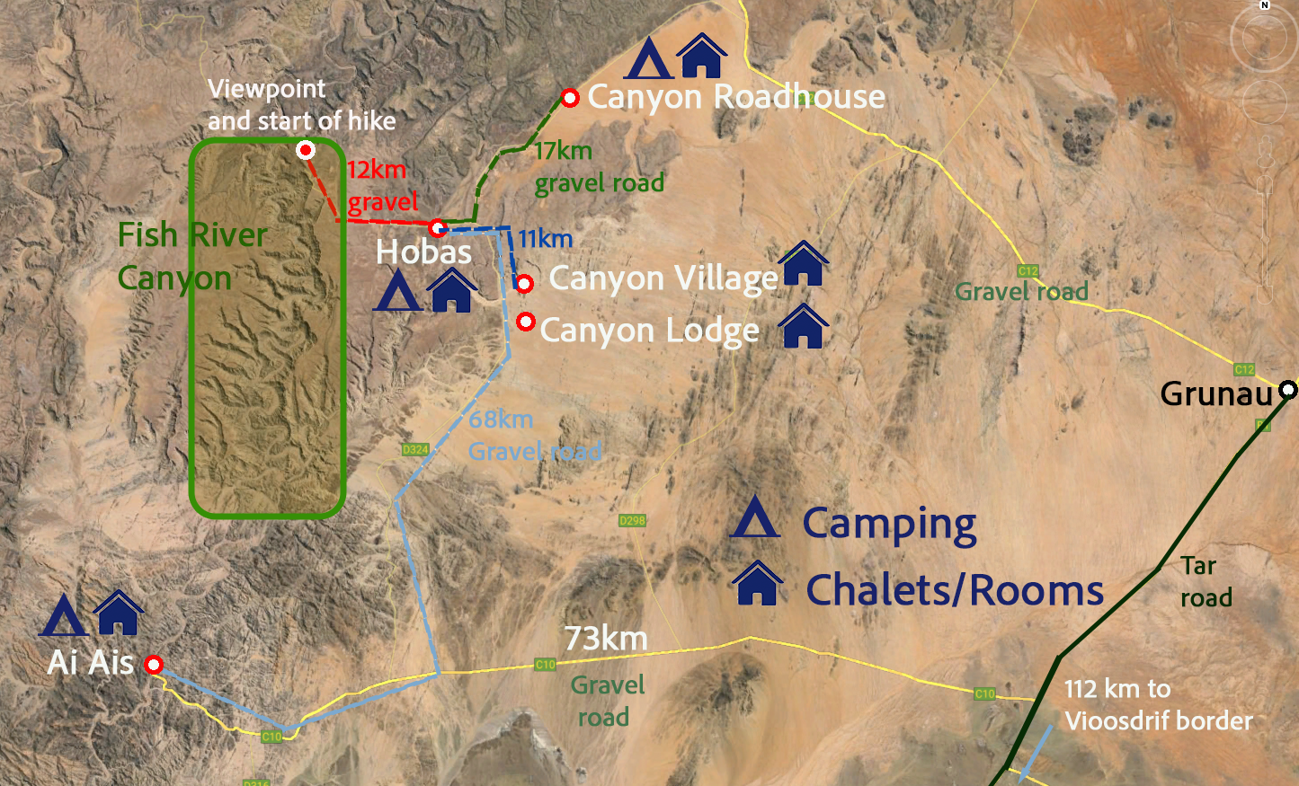
The canyon runs through the fissured Koubis massif in southern Namibia, starting near Seeheim and meandering 161 km down to Ai-Ais. Everything is organised around its two ends: at the north is Hobas — the park gate, the campsite and the start of the hiking trail, with the main viewpoints a 10 km drive beyond the gate — and at the southern end is Ai-Ais, the hot-springs resort where the hike finishes, an oasis in the desolate rocky wastes. The canyon is part of a Nature Conservation Park, so park fees apply.
Fish River Canyon is in the south of Namibia and can be reached by road in a normal sedan car, either from Windhoek or up from South Africa — the gravel approach roads are in reasonable condition, though as always in Namibia, drive gently and watch for corrugations. The nearest small town with services is Grunau, about 65 km away on the tar road between the South African border and Keetmanshoop.
From the Hobas gate it's a further 10 km on a bumpy gravel road to the canyon rim and its viewpoints. Prefer not to drive? We arrange guided tours and self-drive itineraries that take in the canyon — send us an enquiry and we'll put your trip together.
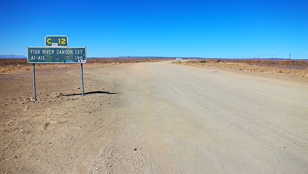
Park entry fees are paid at the Parks office desk by the entrance at Hobas — there is no way of paying in advance. The office has credit card facilities BUT they are not always working (connection issues), in which case you pay CASH: Namibian Dollars or South African Rand only, no other currency accepted and no foreign exchange available in the park. The office is open 8am to 4:30pm, and every visitor must show ID — passport, driver's licence or ID card.

Fees are per day — valid for a 24-hour period beginning at the time of entry — payable for every day for people AND vehicles, with a minimum of 24 hours (no half-day fees). They are non-refundable and non-transferable. Children 0 to 8 years are free of charge. All prices in Namibian Dollars (same value as the South African Rand); fees subject to change without notice.
| Park entry (per day) | Rate |
|---|---|
| Foreign visitors — adults | N$150 per person |
| Foreign visitors — children (9–16) | N$100 per child |
| SADC visitors — adults | N$100 per person |
| SADC visitors — children (9–16) | N$50 per child |
| Namibian visitors — adults | N$50 per person |
| Namibian visitors — children (9–16) | Free |
| Children 0–8 (all nationalities) | Free |
| Vehicle — 10 seats or fewer | N$50 per vehicle |
| Vehicle — 11–25 seats | N$100 per vehicle |
| Vehicle — 26–50 seats | N$400 per vehicle |
| Vehicle — 51+ seats | N$700 per vehicle |
| Hike permits & shuttles | Rate |
|---|---|
| Fish River hiking permit | N$535 per person |
| Shuttle: Ai-Ais → Hobas | N$400 per person |
| Shuttle: Hobas → hike starting point | N$250 per person |
Hikers' tip: get your park permit the day before you start the hike — visit the office, tell them when you're hiking and they'll date your permit from the next day (unless you also want the viewpoint for sunset that day, in which case you pay for that day too). This lets you make the all-important early start on day one.
Four experiences define the canyon — and one important thing to know: there are NO day hikes into the main canyon. You cannot walk in from Hobas or Ai-Ais for a short hike; for the canyon itself it's the five-day hike or nothing. Several nearby lodges do offer shorter day and half-day walks into other parts of the canyon.

10 km from the Hobas gate
Five different viewpoints look down into the canyon from the Hobas (north) end — including the stunning view of Hell's Bend, where the river doubles back on itself half a kilometre below the rim. Pay your park fees at Hobas, then drive the 10 km of bumpy gravel to the rim.
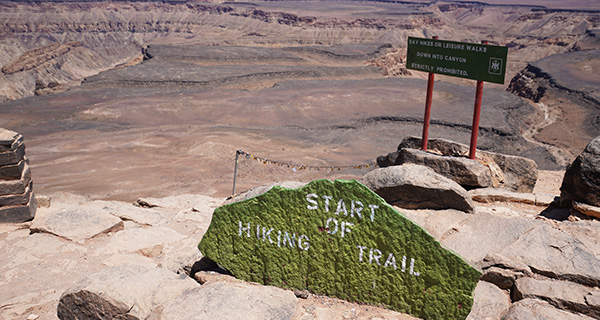
86 km · Hobas to Ai-Ais · May–Sept
One of the most famous hikes in Southern Africa: 86 km through the canyon over 5 days with absolutely no facilities — you carry everything and find water in semi-permanent pools. Requires good physical health, a doctor's certificate and advance booking. Full details below.
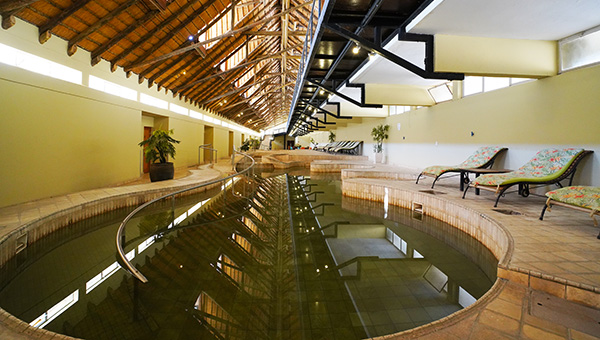
Southern end of the canyon
Ai-Ais means 'place of burning water'. Stay over or day-visit to soak in the naturally heated indoor and outdoor pools — and take warm showers (there's no cold water!). As the end point of the 5-day hike, it's the perfect place to soothe aching muscles.
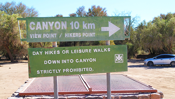
Via surrounding lodges
While the main canyon is strictly 5-day-hike-only, several surrounding lodges offer shorter day and half-day hikes into other parts of the canyon system — a great way to get below the rim without committing to the full trail. Note the descent into Hell's Bend from Hobas is only for permitted 5-day hikers.
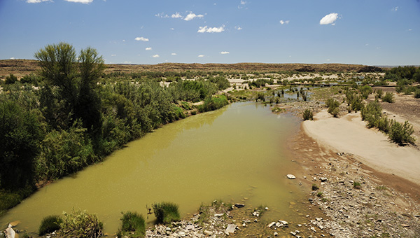
Rainy season · Jan–Apr
Like most Namibian rivers the Fish is generally dry, but in the rainy season it can become a raging torrent through the gorge — a rare and dramatic sight. The rest of the year it retreats into long, narrow pools that keep the canyon alive (and keep hikers supplied with water).
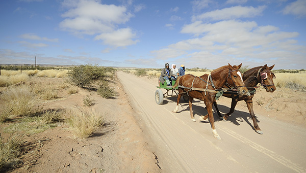
Build it around the canyon
The canyon slots beautifully into a southern Namibia road trip — Luderitz, Aus, the Orange River and on to Sossusvlei. Browse our road trip ideas or simply send us an email with your wishes and we'll put your trip together for you.
The Fish River Hiking Trail is one of the most challenging hikes in Africa: the combination of distance, heat, varied terrain, no resupply for 4 to 5 days and sheer remoteness all add up to challenge both body and mind — while restoring a little bit of your soul. It is 86 km from Hobas to Ai-Ais, normally done in 5 days, with absolutely no facilities along the way: you carry everything and find water in semi-permanent pools.
The essentials: the hike can only be undertaken during the cooler winter months and is open from 1 May to 14 September each year. It requires good physical health — you must produce a doctor's certificate — and it is always a group hike. In summer, temperatures in the gorge are extreme; even in winter it gets quite hot, and past accidents and fatalities have mainly been due to heat stroke and heart failure. Rescue facilities are limited, no helicopters are stationed nearby, and there is no cell reception in the canyon.
The descent starts at Hiker's View, about 3 km north of the Main Viewpoint, and takes almost an hour. Only one 'emergency exit' leads out of the gorge, near Palm Springs — usually reached on day three — via a very steep path that leaves you standing, literally, in the desert. The trail ends at Ai-Ais and its hot pools.
Demand far exceeds supply: a maximum of 30 hikers are allowed on the trail at a time, which makes permits genuinely hard to secure — we recommend trying to book your hike 12 months in advance. A deposit is due within 48 hours to secure your booking (you'll receive a confirmation email once paid), and the balance must be paid 60 days before your hike.
The hiking permit costs N$535 per person, plus park entry fees for your days in the park and the shuttle transfers (Ai-Ais to Hobas N$400 pp; Hobas to the trail start N$250 pp). The easiest route: enquire with us or message us on WhatsApp with your preferred dates and group size, and we'll handle the permits, transfers and accommodation at both ends of the trail.
Depending on your fitness you can hike the canyon in 4, 5 or 6 days. The most common and recommended plan is 5 days and 4 nights sleeping in the canyon, with the fifth night celebrating at Ai-Ais Resort. Distances below are approximate — and remember the golden rule: avoid hiking in extreme heat by making the most of the cooler morning hours.
| Day | Distance | What to expect |
|---|---|---|
| Day 1 | 11–12 km | Descend into the canyon from Hiker's View — steep and rocky, so pace yourself. Beautiful river pools and sandy beaches for a lunch stop; camp on the river banks. In colder months a tent is advisable against cold, windy conditions — otherwise sleep under the stars. |
| Day 2 | 17–18 km | Thick patches of sand and large boulders. Refreshing swims in the river pools are the highlight. Reach Palm Springs by evening and soak in the natural sulphur hot pools before settling in for the night. |
| Day 3 | 17–18 km | Rocky and sandy terrain and a changing, desert-like landscape. Often the mentally toughest day — keep motivated, because tomorrow brings the best scenery. (Palm Springs is also the only emergency exit from the gorge.) |
| Day 4 | 18–19 km | Several shortcut options with elevation changes, stunning views and varied landscapes. Take your time over the unique rock formations with their intricate patterns and shapes. |
| Day 5 | 7–8 km | Easier, mostly flat and solid ground. Take it easy in the morning, savour the surroundings, and finish at Ai-Ais Resort — hot pools, cold drinks and a real bed. Celebrate: you've earned it. |

The trail, albeit a walk, is not by a long shot a cakewalk. It isn't technically difficult, but it is physically demanding — ask yourself honestly: when did you last walk 18 km? Let alone with a loaded pack, in heat, on sand and boulders. With careful planning and thorough preparation it is absolutely conquerable, even for those who aren't seasoned hikers.
Focus on overall endurance, strength and cardiovascular fitness. Mix running, cycling and swimming for the cardio; add strength work like squats, lunges and deadlifts to build the leg and core muscle you'll lean on all day.
Simulate the hike: walks on soft sand and rocky trails wearing your hiking boots and carrying a weighted backpack. This conditions your muscles to the terrain and gets you used to the feel of your actual gear over long distances.
Gradually and steadily increase the intensity and duration of your training. Listen to your body, schedule rest days for recovery and muscle repair, fuel with a balanced diet of carbohydrates, protein and healthy fats, and hydrate well before, during and after sessions.
Mental preparation matters as much as physical conditioning. Visualise yourself completing the hike; know that the preparation you've put in gives you the confidence to overcome any obstacle. Prepare, improve, overcome.
Food, glorious food — never enough to lighten the mood. Strategic meal planning makes a huge difference on this trail. The rule: lightweight, dried, easy to prepare. Don't take tins.
Dehydrated backpacking meals (pasta dishes, rice with curry, stews that just need hot water), instant noodles (quick carbs — look for low-sodium options) and freeze-dried meals, which retain nutrients well and weigh almost nothing. One-pan meals keep your cooking kit light.
In some ways your snacks matter more than your evening meal: your body needs something to absorb the water you drink, so snacking as you walk keeps energy stable and helps you retain fluids. Pack trail mix (nuts, seeds, dried fruit), high-protein energy bars, and biltong — protein plus savoury satisfaction (choose varieties without added sugar or excess salt).
A few treats lift spirits and add nutrients: dark chocolate for a morale boost (and antioxidants), and dried apricots, figs or mango for natural sweetness and vitamins.
Dehydration is the number one reason people need help on this hike. Carry a 1 to 1.5 litre bottle you can reach without removing your pack, and sip constantly — if you feel thirsty, you're already dehydrating. In your pack, carry a backup of 2–3 litres minimum, topping up your drinking bottle every couple of hours and refilling from the river as you pass water. River water is NOT drinkable untreated — filter it or use purification tablets. Add electrolyte sachets (rehydration salts) to keep salts and minerals up, especially important in heat like this.
Use lightweight, waterproof, resealable bags or containers to keep food secure and fresh — and take every scrap of waste out with you to preserve the pristine canyon environment.
You carry everything for five days, so pack light and pack smart — there's an art to loading a backpack for a trail like this. Everything should be worn in, tested and comfortable long before you start. The full kit, category by category:
THE most common irritant on the trail is sore feet — aching and swollen at best, blistered at worst. Think about it: when did you last spend 6 to 8 hours walking, let alone carrying several kilos on your back? Good, well-worn-in, comfortable, sturdy hiking boots can make or break your experience.
Buy your boots at least 6 months before the hike and wear them in until you can wear them 10 hours a day without knowing they're on your feet — start with an hour a day as part of your fitness walks, then build up. Do a few long hikes with your fully loaded pack to work out any kinks in the fit.
Socks are almost as important: take six pairs of wool socks — they air well, and need to be thick enough to pad your feet from the boot without causing rubbing. Hike in one pair, change into a fresh pair at camp each evening. (Two thin pairs at once doesn't work — it causes rubbing, slipping and blisters.) Add flip-flops, crocs or sandals for camp.
One thing is certain in the vastness of the canyon: cell reception is virtually non-existent. And even if you could contact someone, there are only two evacuation points you'd need to reach. Google Maps works offline if downloaded beforehand — keep that battery charged — but for genuine emergencies (a twisted ankle, sudden illness, the unforeseen) a satellite phone is the lifeline when normal signals fail.
Yes, it's extra weight — but for peace of mind and the ability to call for help, it's a small sacrifice. Being prepared isn't just packing the essentials; it's anticipating the unexpected. Satellite phones can be rented for the duration of the hike from suppliers in South Africa and Namibia — message us on WhatsApp and we'll point you to a rental option that suits your route.
Here's the uncomfortable truth: normal travel and household insurance does NOT cover the Fish River Canyon hike, because it's considered too extreme. The canyon's remote setting means emergency rescues are usually carried out by helicopter to the nearest hospital — complex and very expensive — and standard policies built for trip cancellations, lost luggage and conventional medical mishaps simply fall short.
Specialised cover exists: SATIB (Specialist Accident and Travel Insurance Brokers) offers policies custom-built for the Fish River hike, covering helicopter evacuations, emergency medical care and the other unexpected costs of an extreme, remote adventure.
Whatever policy you choose, check four things: that helicopter rescue and transport to a medical facility is included; that medical coverage is comprehensive, including treatment and evacuation; that extreme activities and remote-location hiking are explicitly covered; and the coverage limits and exclusions, so there are no surprises in an emergency. Then hike with a clear head.
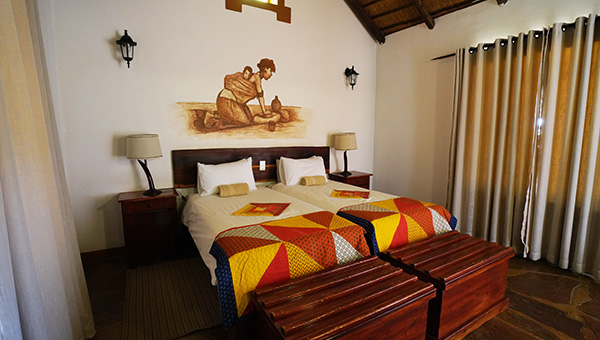
There are five places to stay close to the canyon, each with its own role:
Further away is Grunau (65 km), which has its own selection of places to stay. All the options with price guides are on our Fish River Canyon accommodation page.
For the hike there's no debate: the trail is only open from 1 May to 14 September each year, when the winter temperatures make the gorge survivable. Book your permit up to 12 months ahead for dates in this window — May, June and early September offer slightly warmer nights, while mid-winter brings the coolest hiking days and cold nights in the canyon.
For the viewpoints and Ai-Ais, the canyon is open year-round, and the winter months (May–September) are the most comfortable then too, with moderate days of 20–28°C. Summer (October–March) visits are possible but demand planning around the extreme heat — sunrise and late afternoon at the rim, the pool in between. The dramatic bonus of the rainy season (January–April) is the chance of seeing the Fish River in flood, a raging torrent through the normally dry gorge.
The canyon area has a typical semi-desert climate with an average annual rainfall of just 100 mm.
Temperatures can rise to 48°C during the day and only cool to about 30°C at night. Relief comes in short spells with occasional thunderstorms. This heat is exactly why the hike is closed in summer — and why past tragedies on the trail have mainly been heat stroke.
Short winters with nights that can drop below zero, quickly warming to a moderate 20–28°C by day — ideal walking weather, but pack proper warm layers and a good sleeping bag for those canyon-floor nights.
The park office at Hobas has credit card facilities, but connection issues mean they don't always work — so carry enough cash for park fees as backup, in Namibian Dollars or South African Rand only (they're worth the same). No other currency is accepted and there's no foreign exchange in the park. The lodges generally take cards, but in this remote corner of Namibia cash is the reliable fallback for fuel, tips and small purchases. The nearest banking is in Grunau or Keetmanshoop — sort your cash before the final gravel stretch.
The canyon is part of a Nature Conservation Park, and the rules exist because this is one of the few truly pristine places left. The main canyon is closed to day hikers — descent is only permitted as part of the booked 5-day hike, in season (1 May–14 September), with a permit, a doctor's certificate, and as a group. A maximum of 30 hikers are allowed on the trail at a time.
NO open fires are permitted inside the canyon — it's extremely dry and fire spreads fast, and the dead wood scattered along the way is habitat for the insects that feed the canyon's reptiles, birds and small animals. Cook on a camping stove only. Take all waste out with you, leave no trace, and disturb this delicate environment as little as possible so it's preserved for generations to come.
You've decided to hike the Fish River Canyon — a remarkable, tough hike that may well change your life. The best advice we can give is one word: prepare. In a world where everyone wants a quick hack, the key to making this a positive, life-changing experience is good preparation over time. That preparation is also what gets you mentally ready — knowing you've put in the work gives you the confidence to overcome any obstacle.
And if you're not hiking? The rim viewpoints, Hell's Bend and a long soak at Ai-Ais make the canyon one of southern Namibia's great road-trip rewards. Either way, we'll set it all up for you.
Guide read — now the good part
A hike permit secured a year out, shuttles between Ai-Ais and Hobas, a chalet at the trail's end with hot springs waiting — or simply the best-placed lodge for the viewpoints. One message with your dates, and a real person takes it from there. No booking fees.
You pay each place's own rate — nothing on top.
We know where the value hides at every gate.
First-hand — we've walked those 86 km and soaked at Ai-Ais after.
Real people, replies usually the same day.